Log in
All resources
Create a design
41,525 Free Images of 1892 Maps
1552
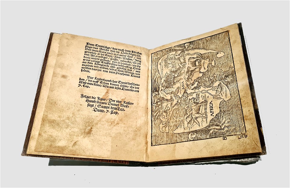
geographiae claudii ptolemaei alexandrini (münster
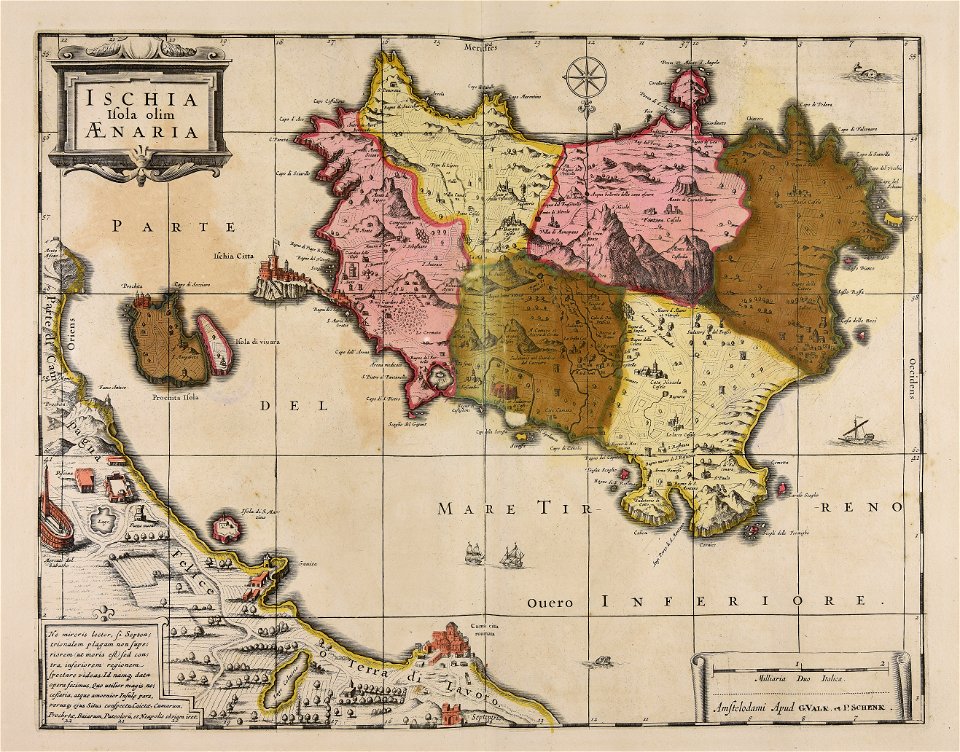
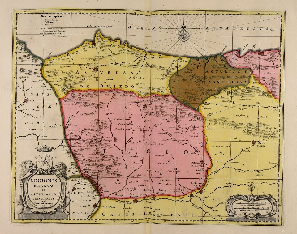
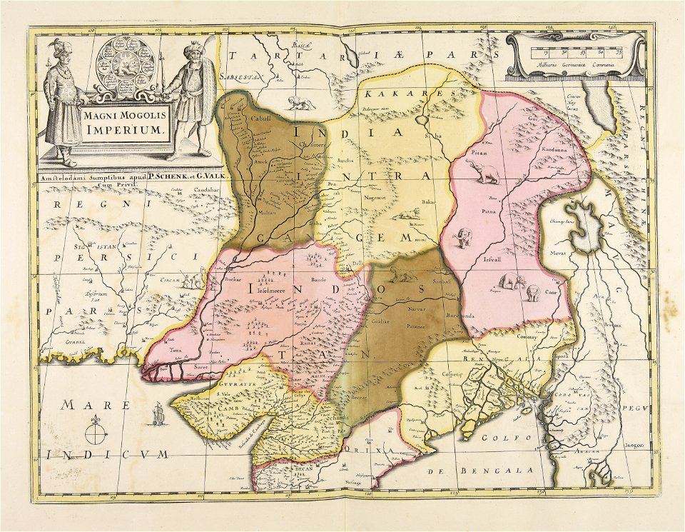
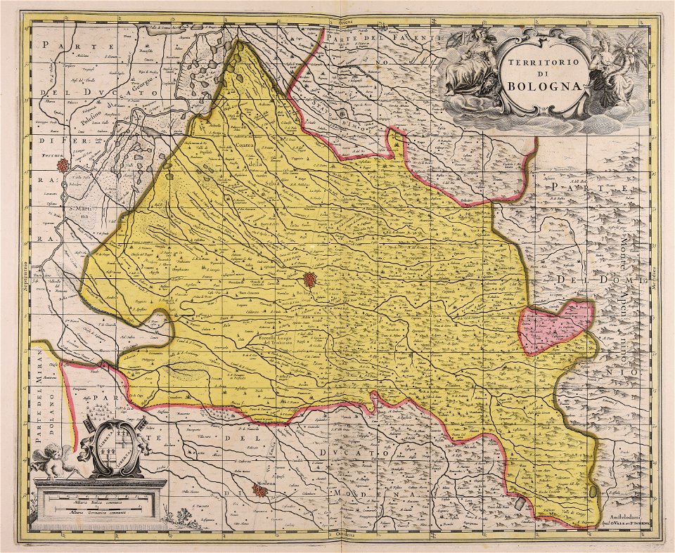
gerard valck
maps made in the 17th century
maps by pieter schenk (i)
atlantis magni tomus quintus (biblioteca comunale di trento)
maps made in the 18th century
atlantis magni tomus tertius (biblioteca comunale di trento)
maps from the mechanical curator collection
maps from the mechanical curator collection available to georeference
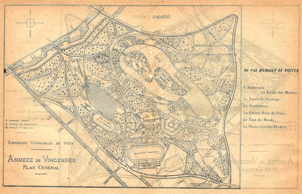
illustrations du catalogue remboursable de l'expo 1900
maps of the exposition universelle (1900)
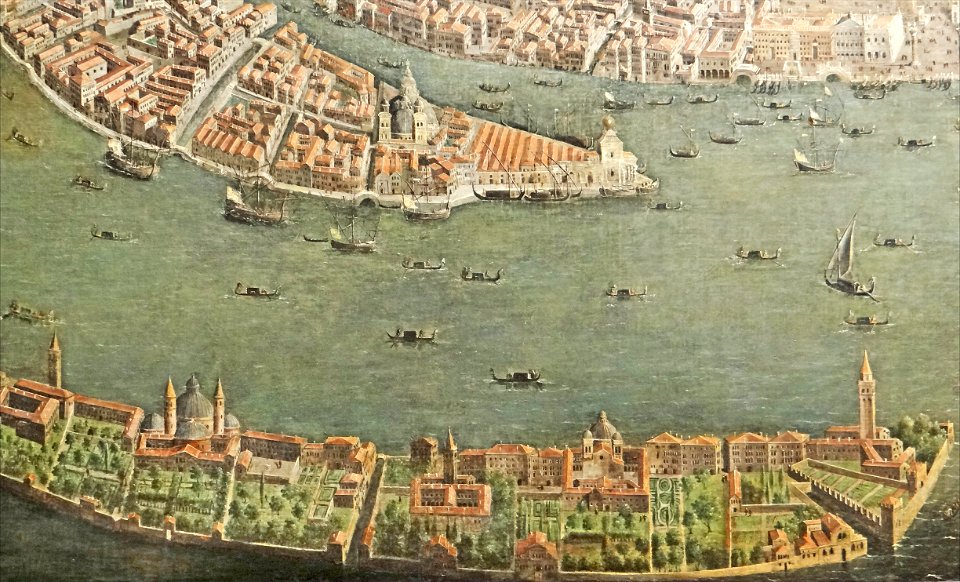
paintings of san giorgio maggiore (venice)
17th-century paintings from italy
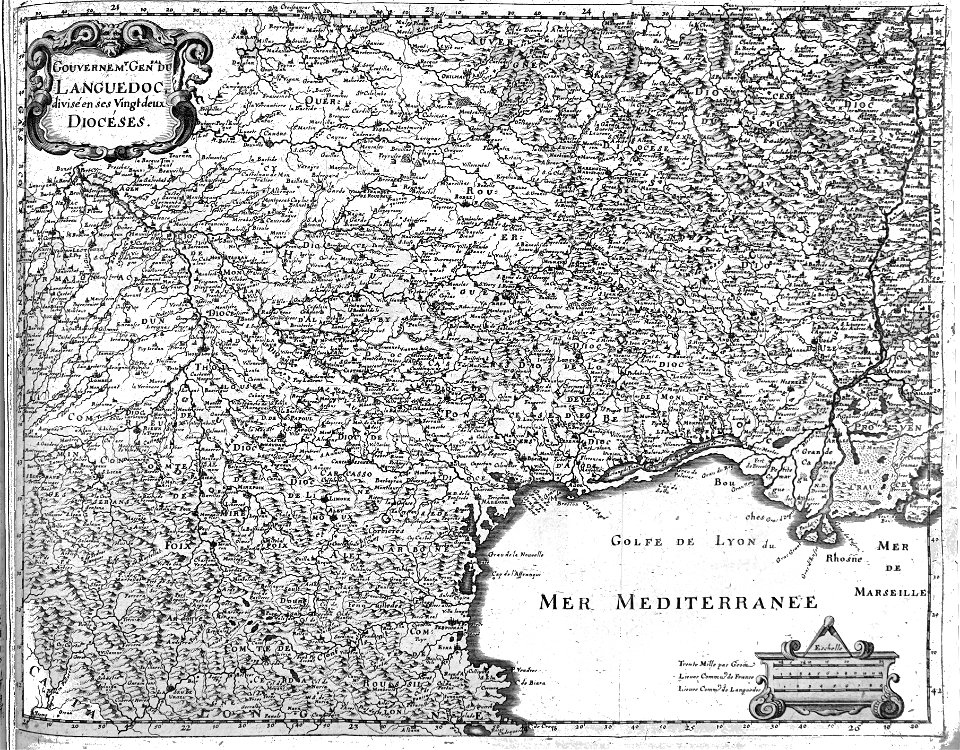
maps made in the 17th century
nicolaes visscher ii
maps made in the 17th century
nicolaes visscher ii
maps made in the 17th century
gerard valck
maps made in the 17th century
gerard valck
collections de la bibliothèque nationale et universitaire de strasbourg
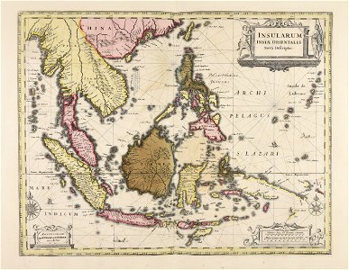
old maps of asia
mannheim in the 17th century
maps of mannheim
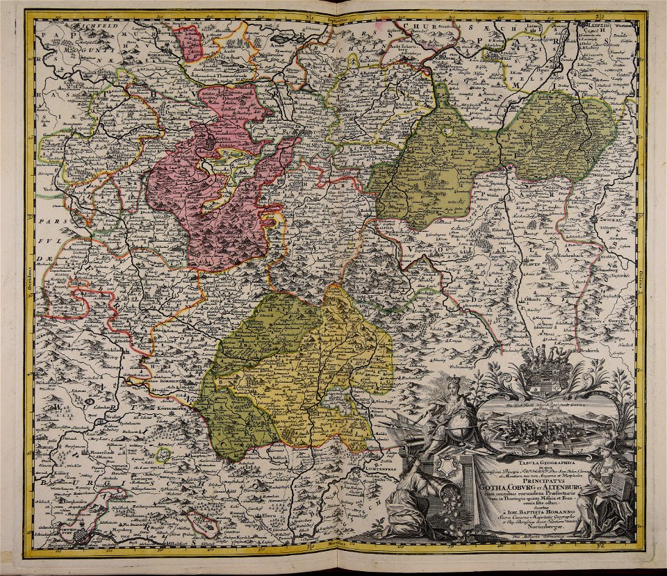
maps made in the 18th century
johann baptist homann
maps from the mechanical curator collection
british battles on land and sea
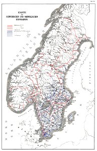
history of rail transport in norway
rail transport maps of norway
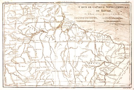
1780 in brazil
1780 maps
maps made in the 18th century
johann baptist homann
maps made in the 17th century
gerard valck
maps of waterways in the netherlands
collections of stadsarchief delft
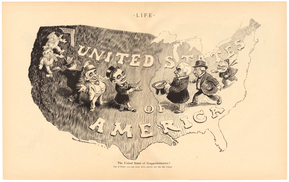
life
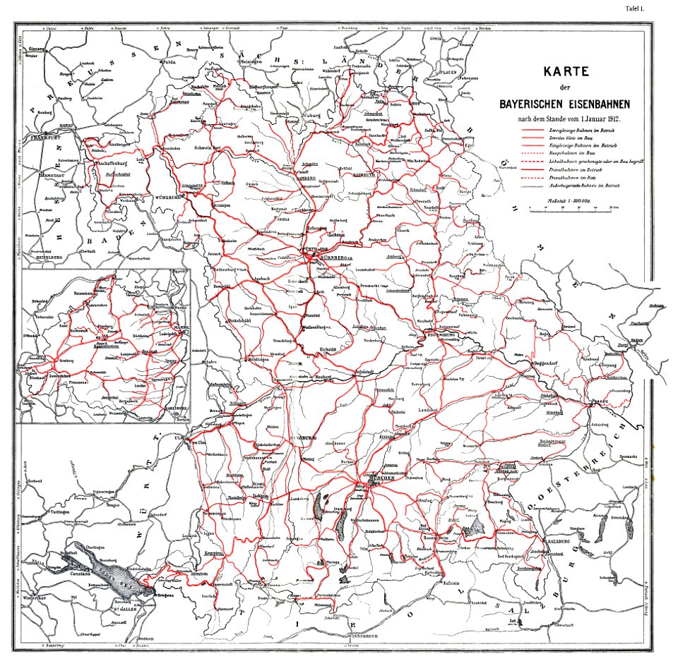
1912
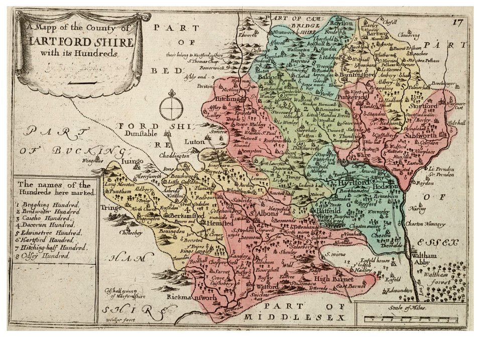
university of toronto wenceslas hollar digital collection
old county maps of sussex
university of toronto wenceslas hollar digital collection
history of watford
university of toronto wenceslas hollar digital collection
old county maps of cheshire
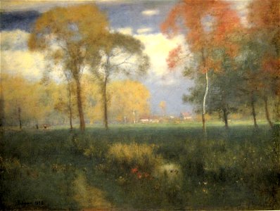
1892 oil on canvas paintings
1892 paintings from france
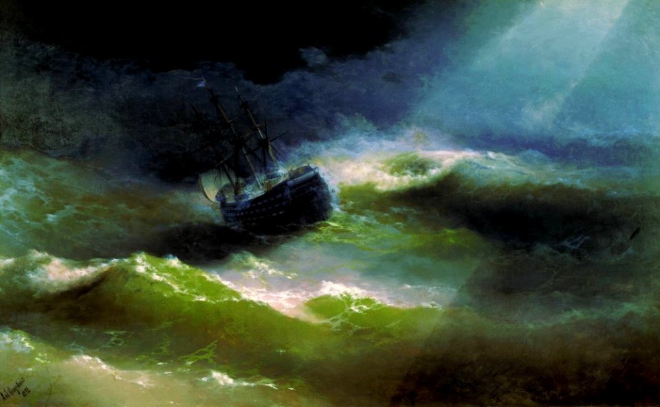
paintings of ships in distress
sea storms in art
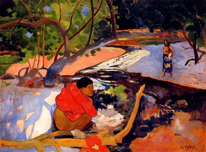
paintings by paul gauguin in private collections
1892 paintings
oil still-life paintings of flowers by henri fantin-latour
1892 paintings
artworks without wikidata item
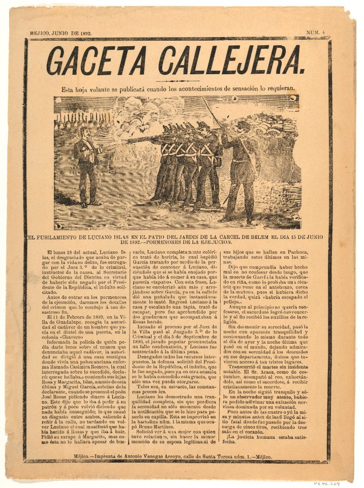
1892 in mexico
artworks without wikidata item
1892 in mexico
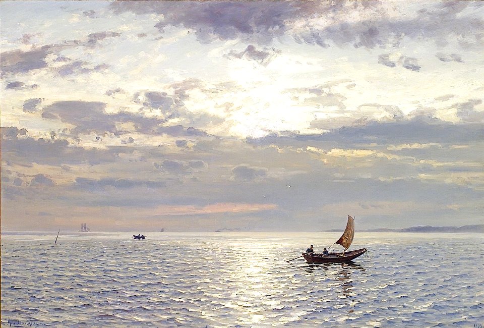
19th-century oil on canvas paintings of landscapes in norway
evening in art
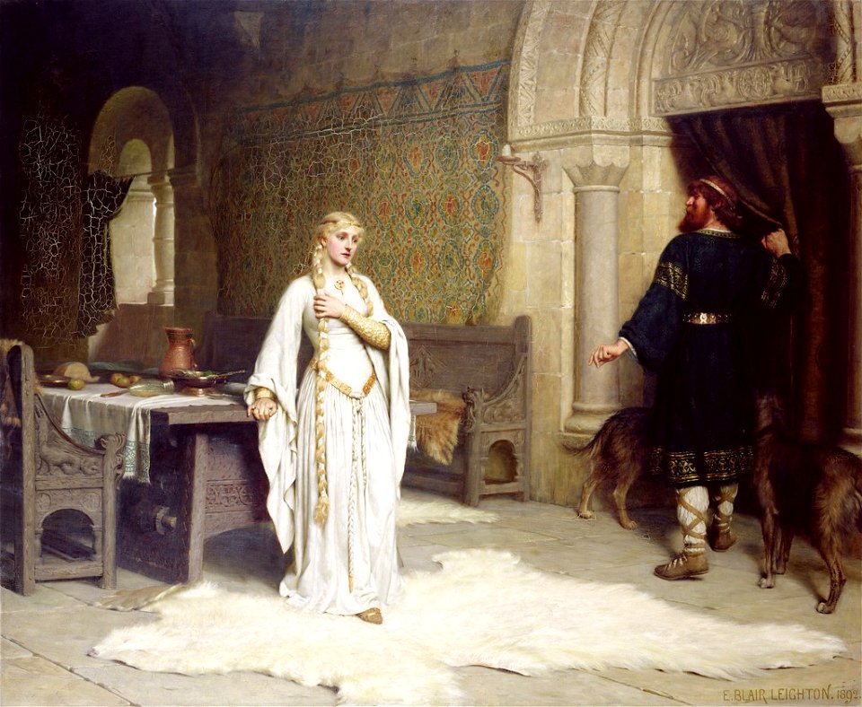
hand on chest
middle ages
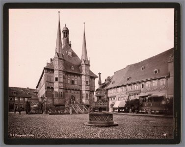
town hall in wernigerode historical views
photographs in the rijksmuseum amsterdam
paintings of cemeteries
1892 paintings
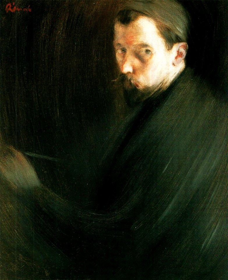
portraits of painters from russia
kaposvár
portrait paintings of men wearing black top hats
1892 portrait paintings of men
landscape paintings in the cleveland museum of art
1892 paintings
1890s maps of ethiopia
fra mauro map details
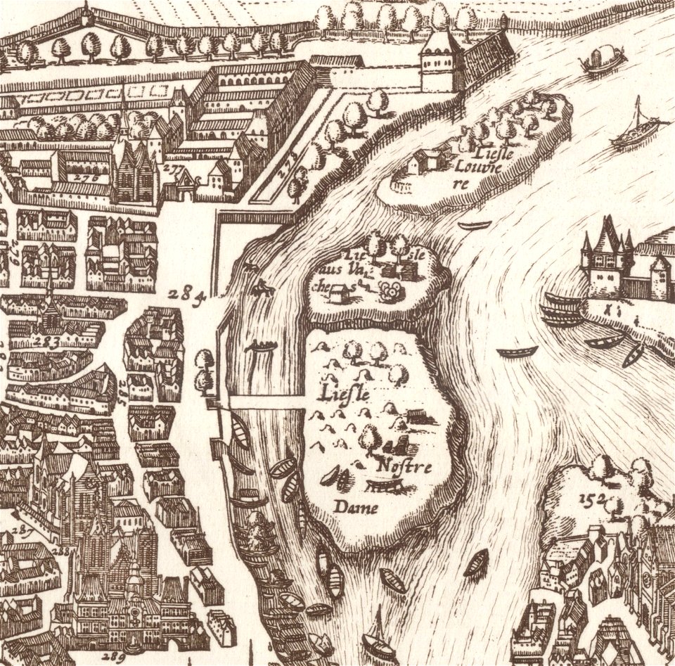
old maps of île de la cité
île saint-louis
the graphic 1901
william t. maud
coats of arms of blois
henry
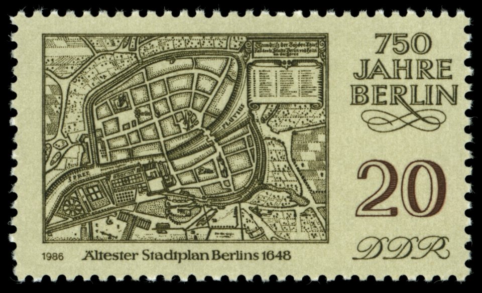
maps of the history of berlin
17th-century maps of berlin
paintings by christian meyer ross
nini roll anker
coats of arms of cities in vienne
frédéric-auguste laguillermie
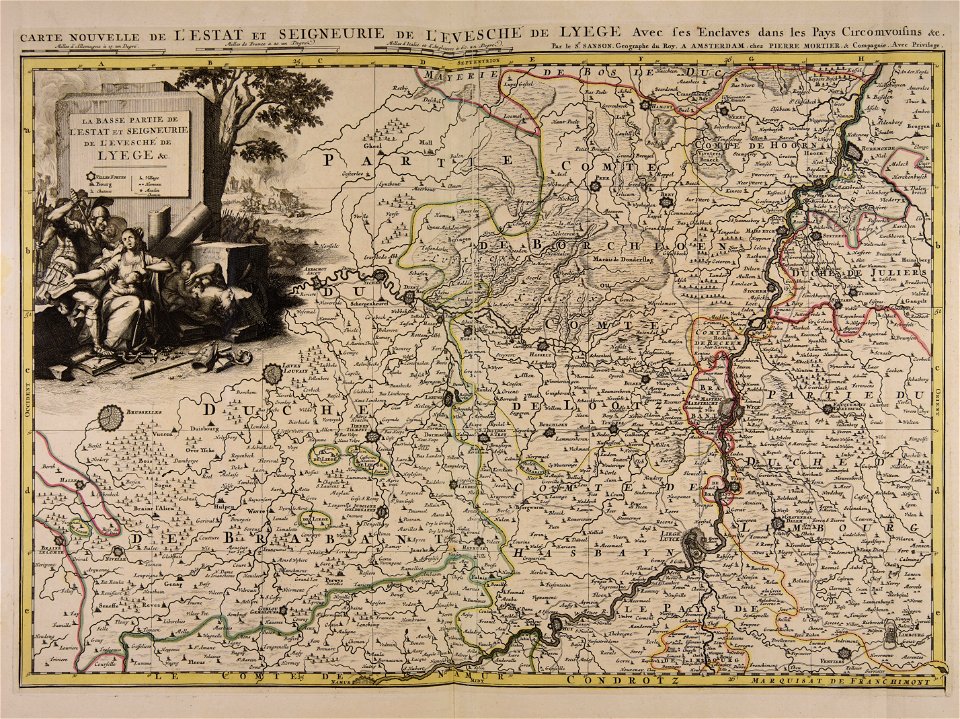
maps made in the 17th century
guillaume sanson
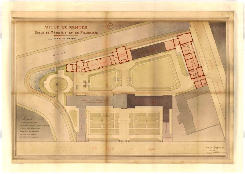
rennes in the 1900s
old maps of rennes
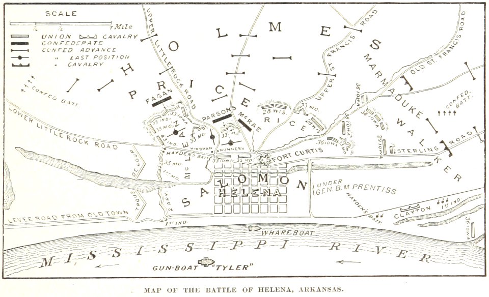
battles and leaders of the civil war (1887)
maps from the mechanical curator collection
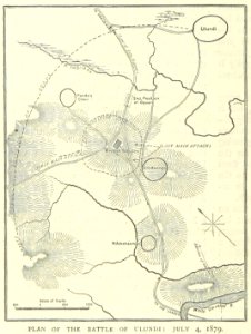
illustrated battles of the nineteenth century
1895 drawings
illustrated battles of the nineteenth century
1895 drawings
illustrated battles of the nineteenth century
1895 drawings
old maps of braunschweig
atlas van der hagen
carolus magnus in art
allegory
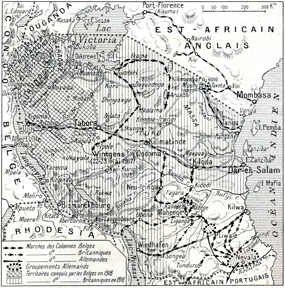
hand-drawn maps and views of world war i battlefields by h.m.
1917 maps of lithuania
gerard valck
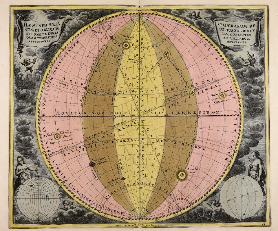
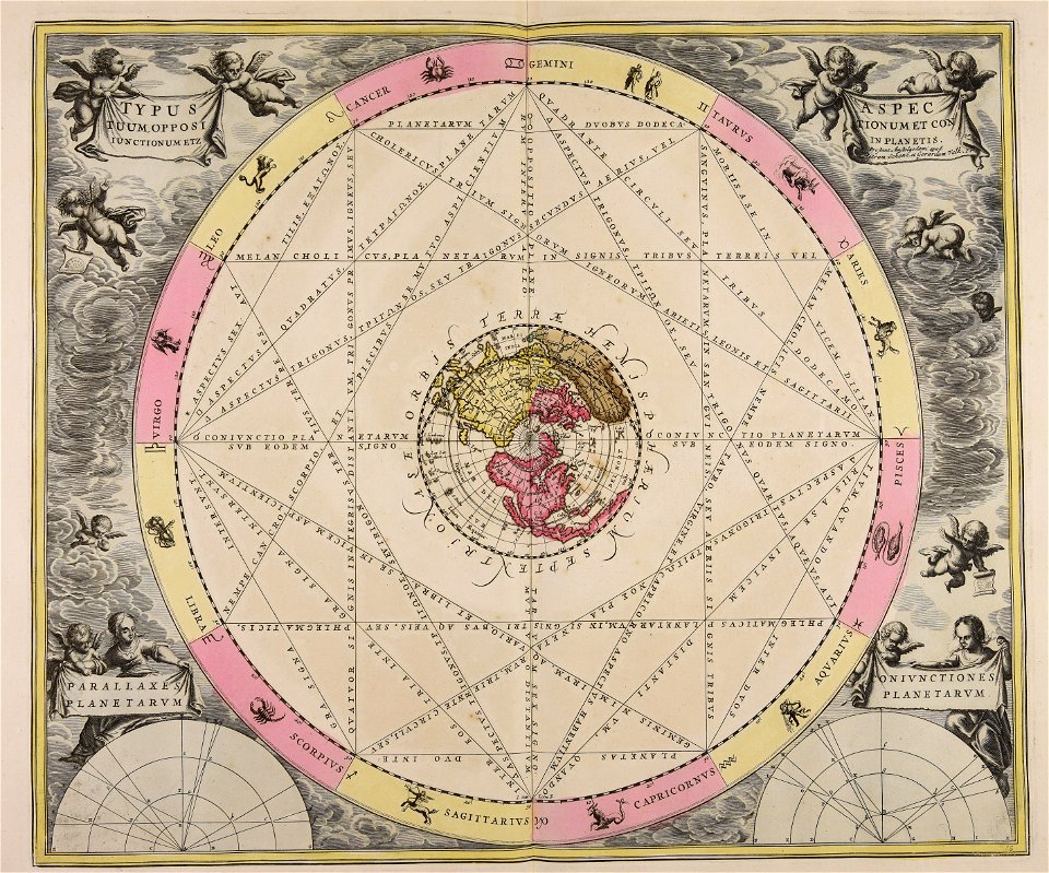
earth
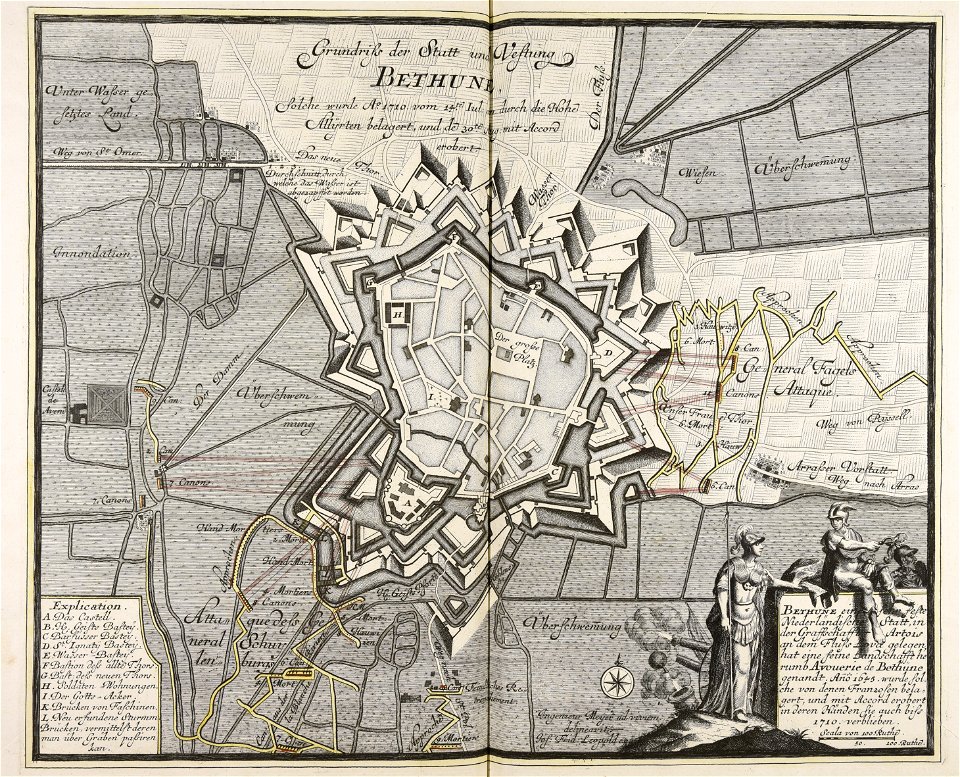
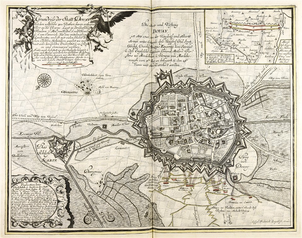
old maps of béthune
1710
war of the spanish succession
1710
gerard valck
indonesia
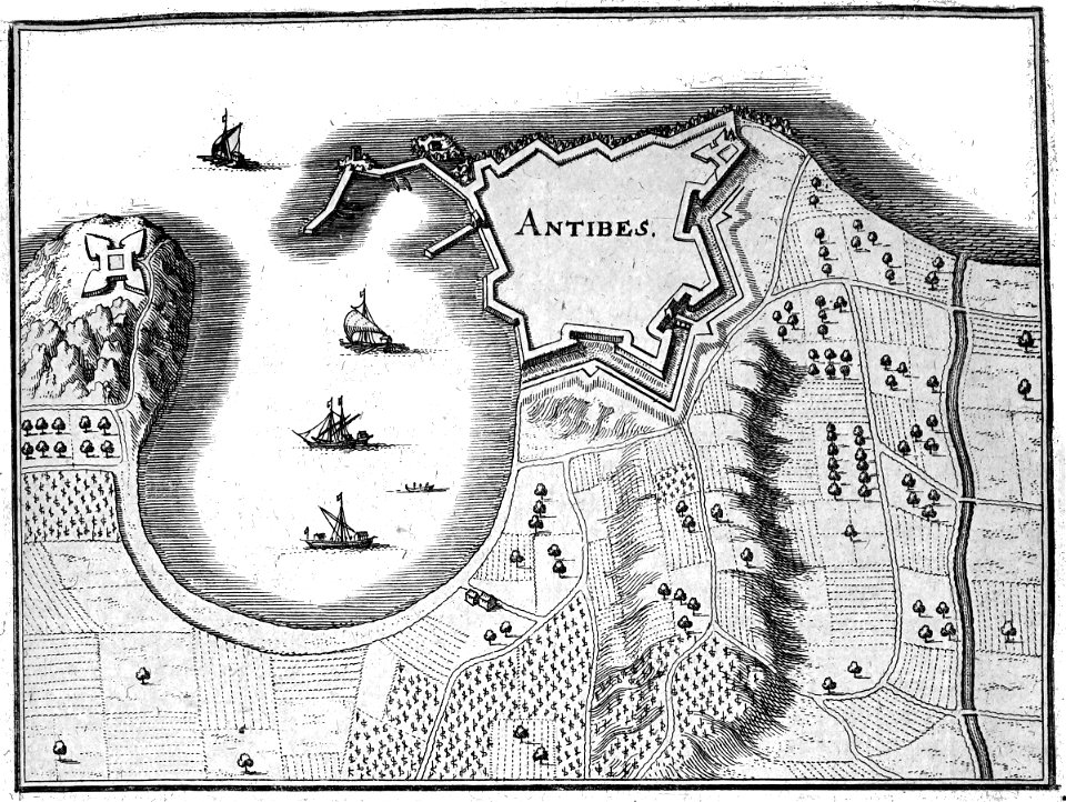
prints from manesson travaux de mars at the peace palace library
fortifications in france
coats of arms on maps
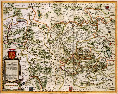
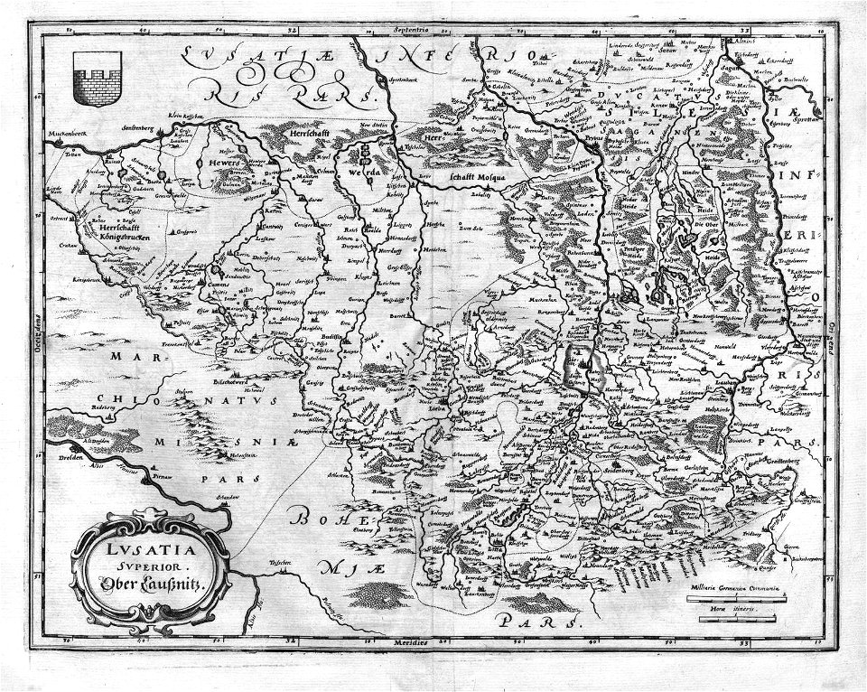
thüringiae
maps made in the 18th century
gerard valck
maps made in the 18th century
johann baptist homann
charts and maps of the royal museums greenwich
1590 maps
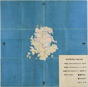
nagasaki
iki
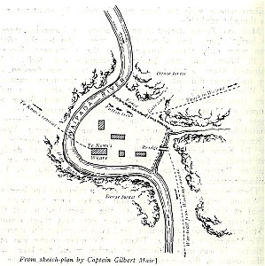
military history of new zealand
maps of battles
maps by pieter schenk (i)
gerard valck
maps by willem and johannes blaeu
circumvallation
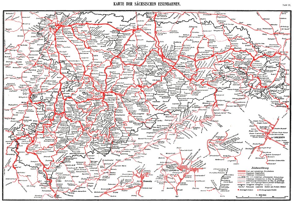
königlich sächsische staatseisenbahnen
enzyklopädie des eisenbahnwesens
1912 in rail transport in germany
enzyklopädie des eisenbahnwesens
prince-bishopric of osnabrück
gerard valck
maps in the rijksmuseum amsterdam
old maps of haarlem
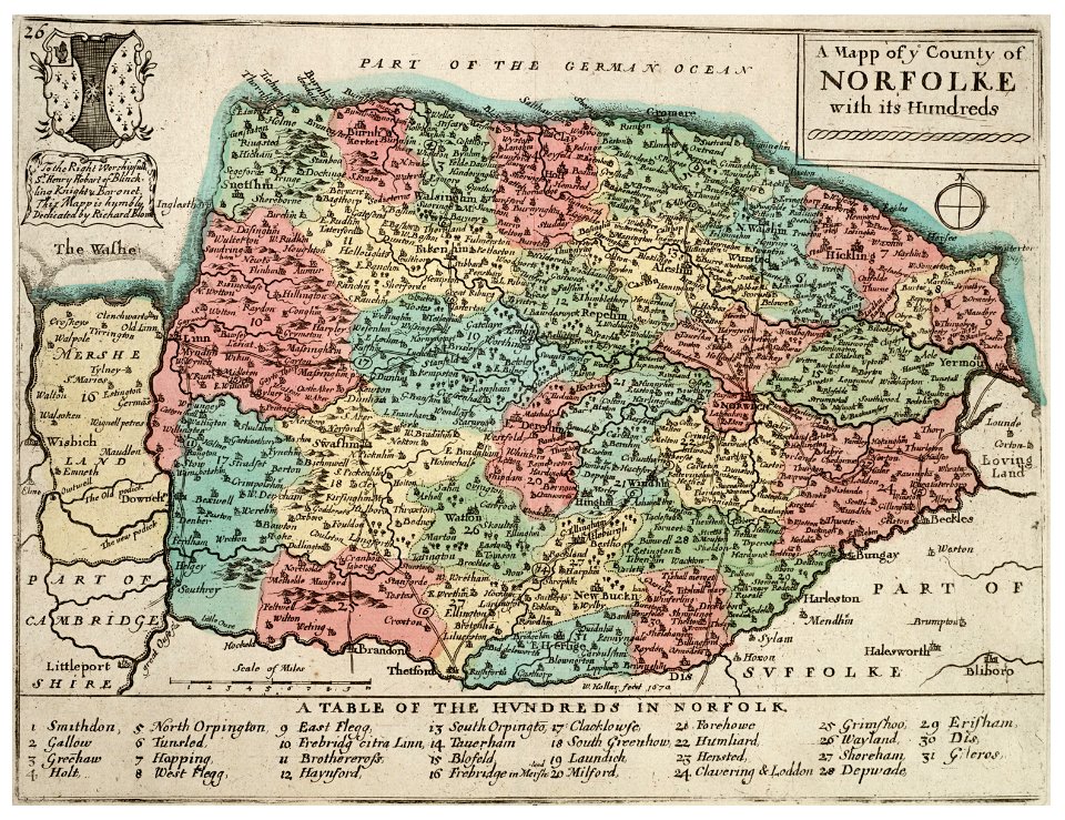
history of norfolk
england
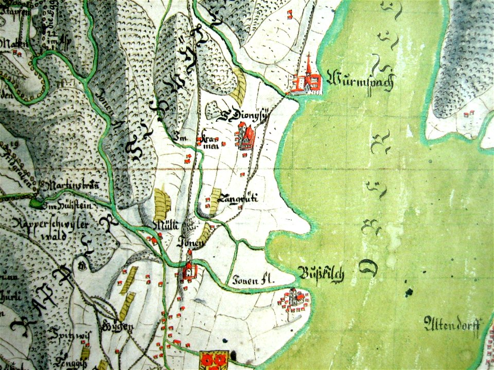
mariazell wurmsbach abbey
gygerkarte
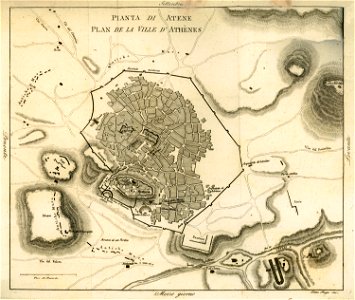
old maps of athens
1805
images from akg-images
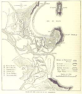
siege of vienna
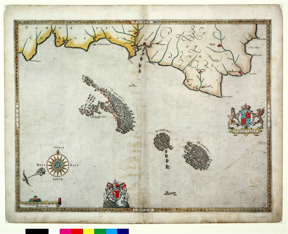
lawrence h. slaughter collection of english maps, charts, globes, books and atlases
nypl lionel pincus and princess firyal map division
1890s maps of the united kingdom
the birds of devon (1892)
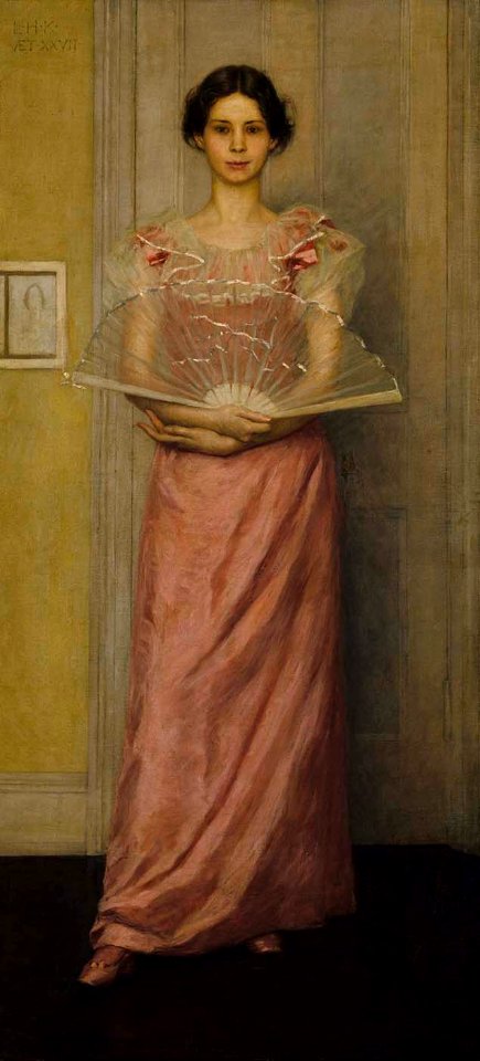
19th-century portrait paintings in the united states
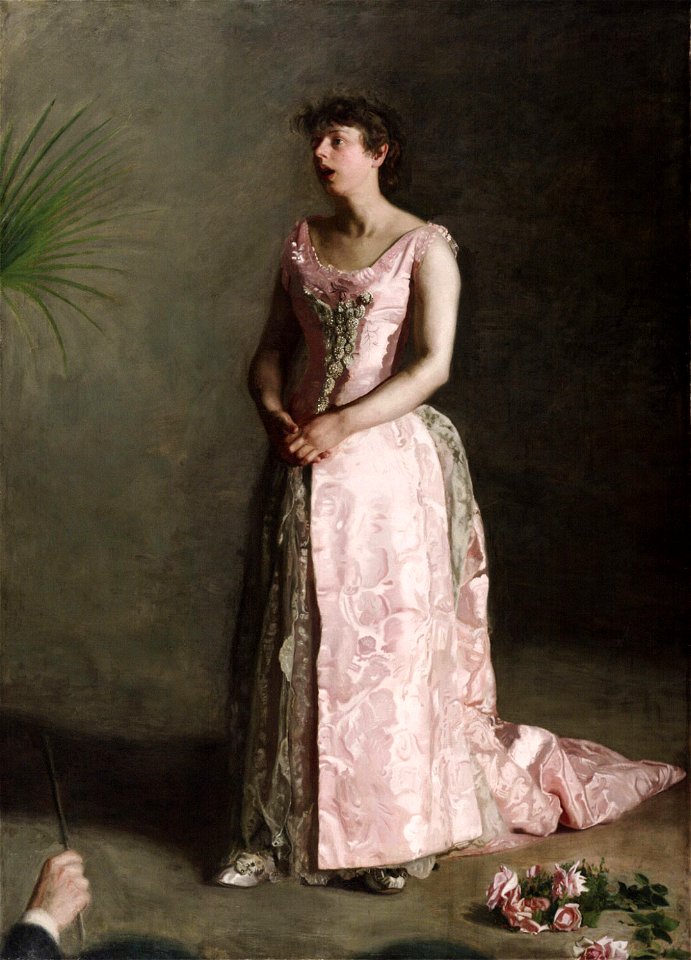
female portrait paintings by thomas eakins
front view portrait paintings of females
female
painting on barn
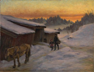
lysaker
facing right
graz
maps from the earth and its inhabitants, vol. xii
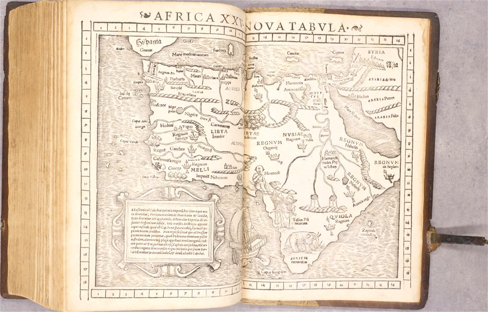
africa in the 1890s
waldburg (adelsfamilie)
coats of arms on maps
charts and maps of the royal museums greenwich
joan martines
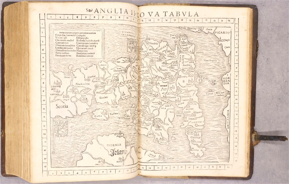
old maps of england
1552
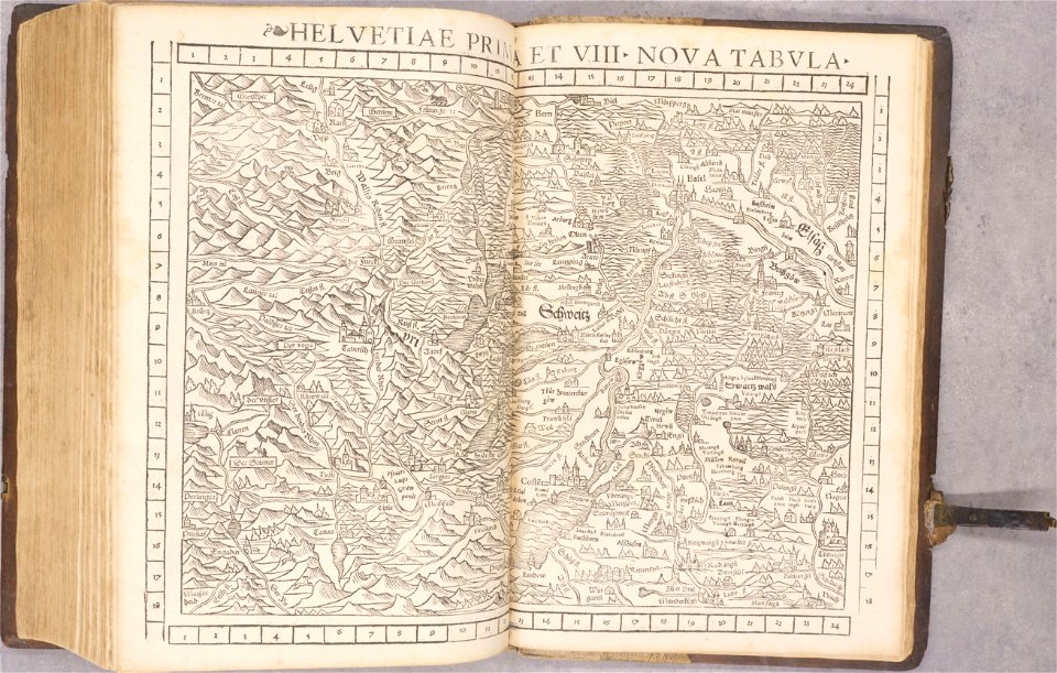
old maps of switzerland
1552
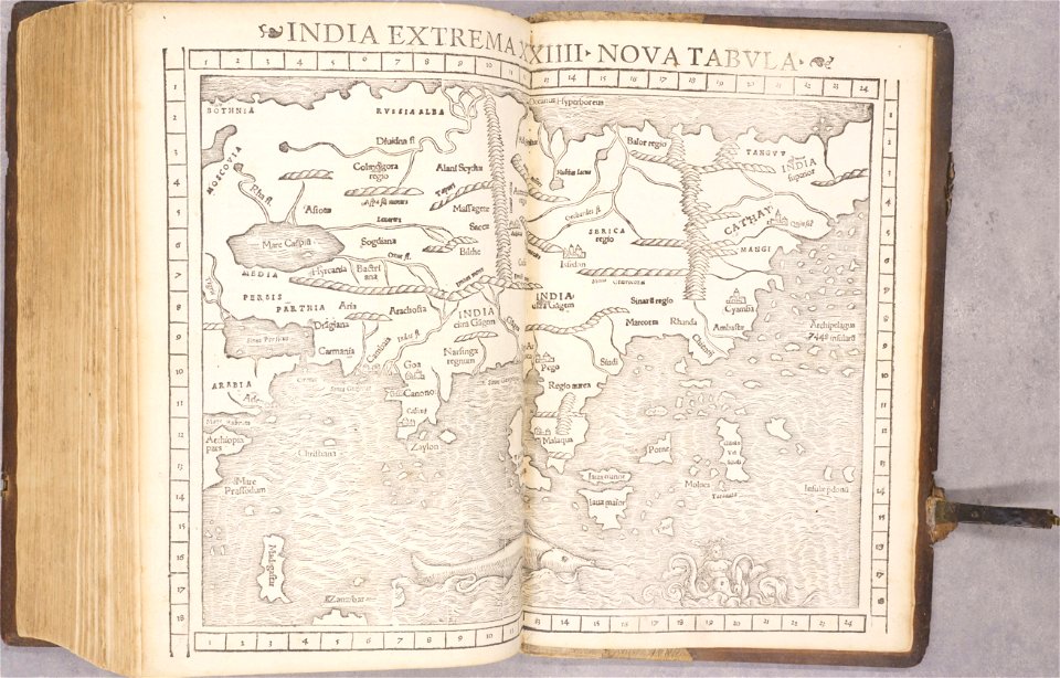
old maps of asia
1552
collections of staatsbibliothek bamberg
history of bamberg
maps of gamla stan
1862 in stockholm
old maps of bohemia
1552
old maps of transylvania
1552
1550s maps of africa
1552
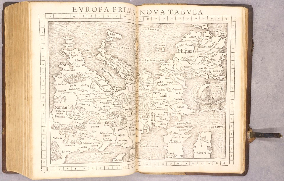
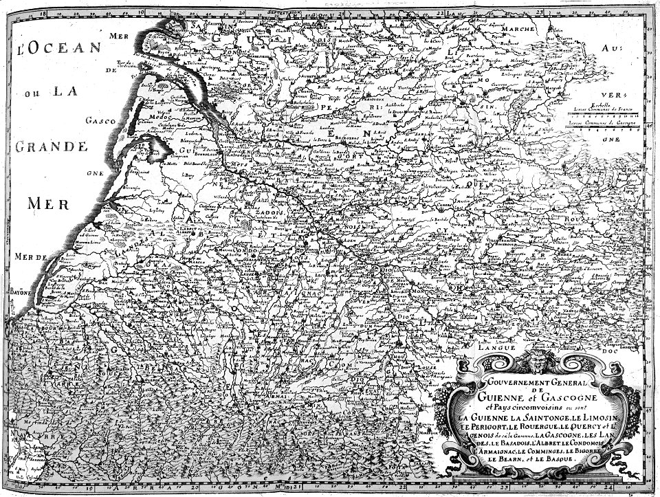
old maps of france
1552
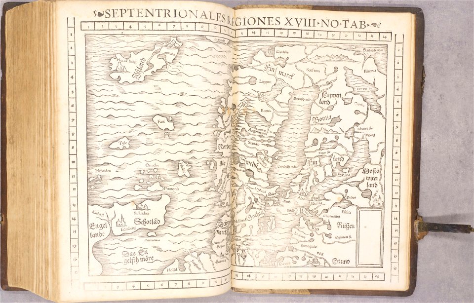
old maps of scandinavia
1552
geographiae claudii ptolemaei alexandrini (münster
1552
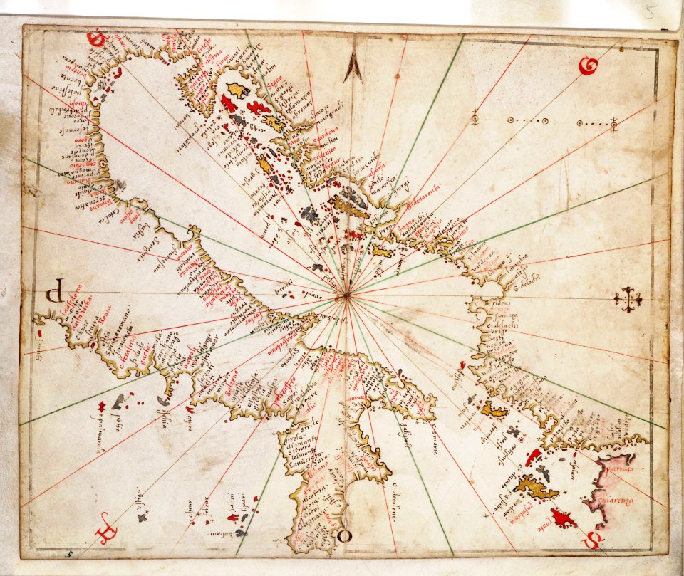
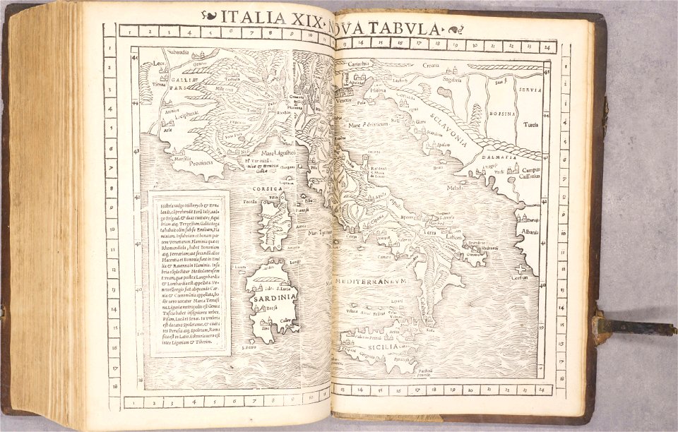
old maps of italy
1552
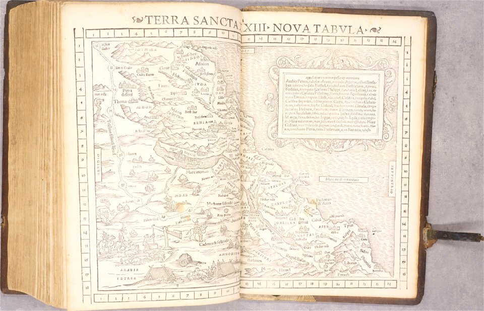
old maps of palestine
1552
maps by gerardus mercator
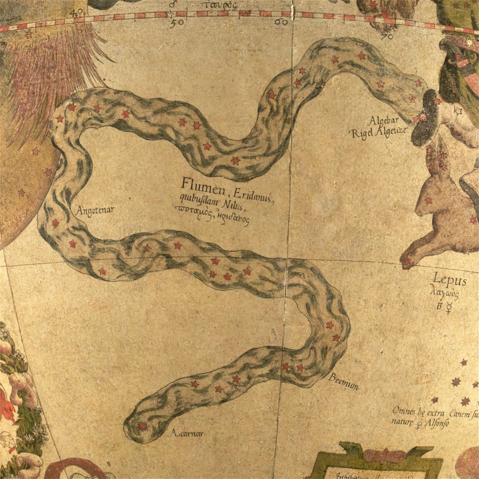
eridanus in art
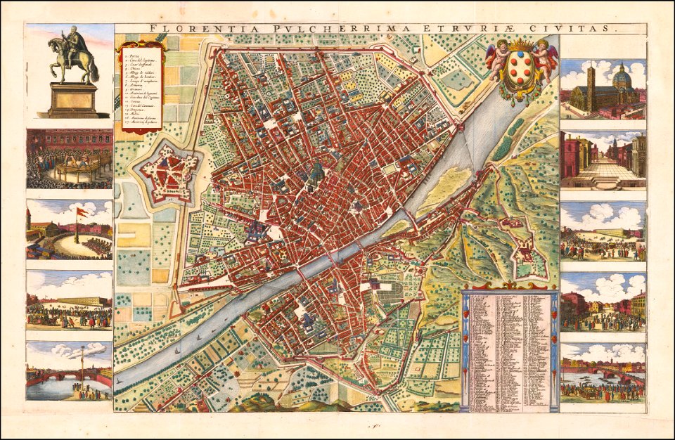
florence in the 1660s
wenzel hollar
bibliothèque municipale de reims
rès. g 153
bibliothèque municipale de reims
rès. g 153
african theatre maps of world war i
no 3908 illustrations
bibliothèque municipale de reims
rès. g 153
geographical illustrations by coronelli
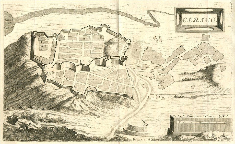
engravings of kythira
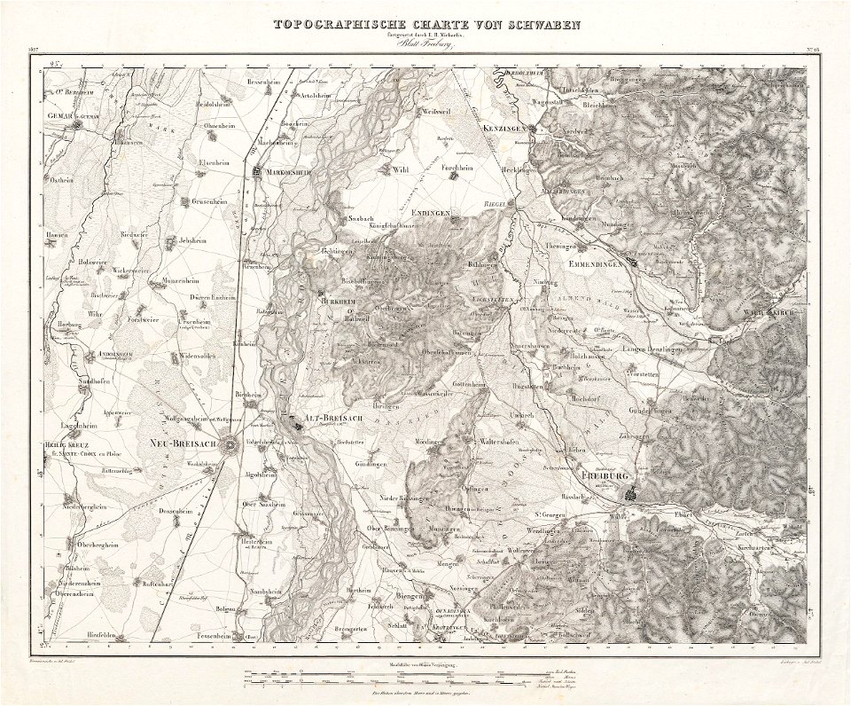
charte von schwaben (bohnenberger)
old maps of freiburg im breisgau
bibliothèque municipale de reims
rès. g 152
8801 - 8900 of 41,525
Next page
/ 416